|
This is from Ned Greene (October 12, 2007):
The weather radio was calling for NW gusts to 30 mph, and, unusually, I had the day off. So I packed up and headed to
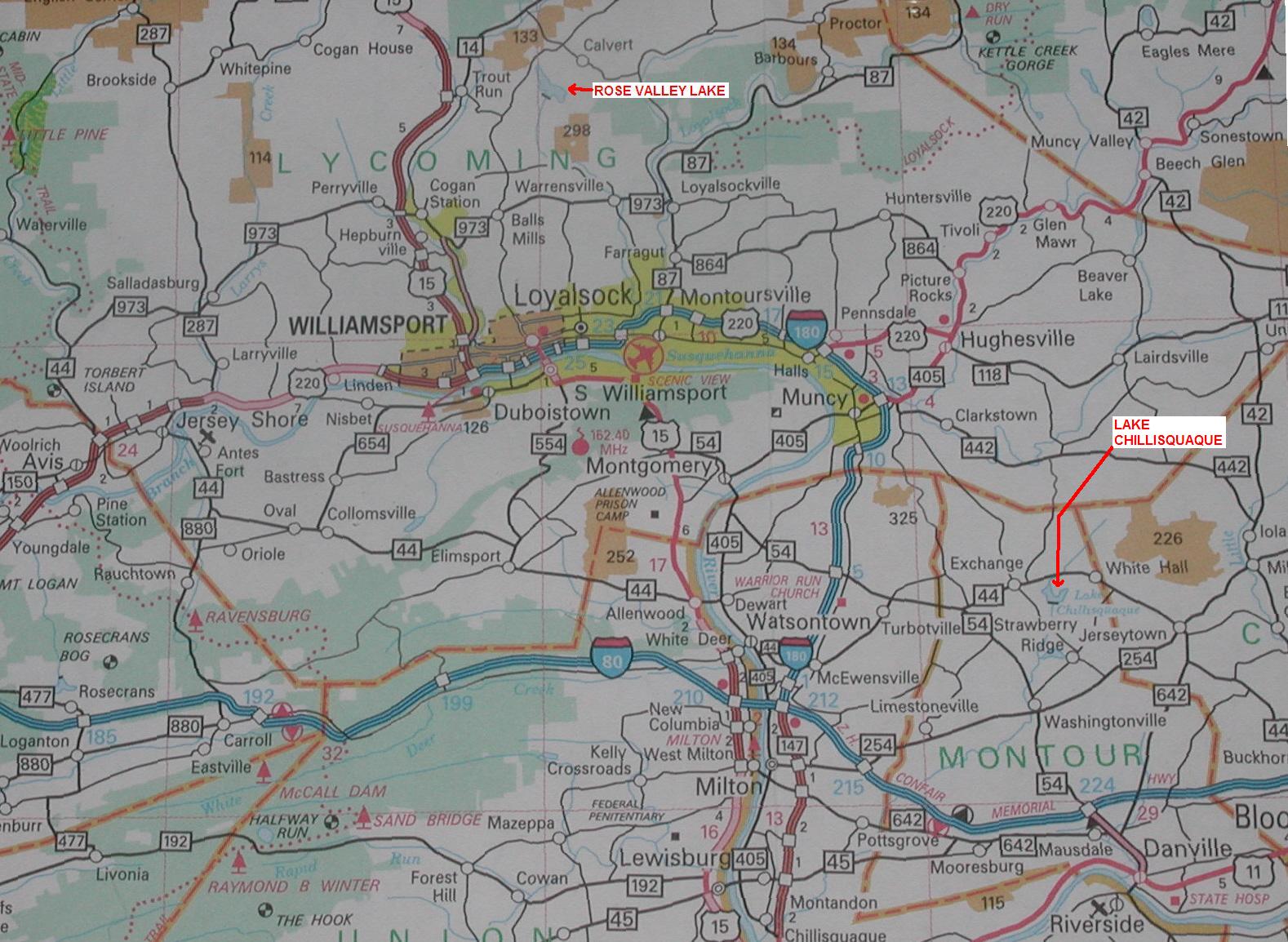
Montour Preserve [containing Lake Chillisquaque], where the coal-burning plant is (near White Hall, PA). They have a man-made
lake that is close to a mile across at its widest end by the dam. There is not much lake for fetching the wind, but the surrounding
land is very low on all sides.
My 4/3 wetsuit was amply warm, and my 7.5 sail (with 125-liter board) was overpowered in the gusts. Plane-through carving
jibes in Pennsylvania? Yes, and lots of them! After down-rigging to a 6.1 sail, I was still doing speed runs in the gusts.
It was definitely my best day of PA sailing. Oh, and did I mention that the parking lot was empty?
There are two launch sites, straddling the widest portion of the lake. The one on the east side has a bathroom and a
boat ramp. The one on the west side is right by the dam, has a nice grassy area for rigging, a nice stone beach, and no bathroom
or port-a-potty facilities (though there are nearby woods). At its deepest, the lake is about 30 feet deep. The water was
not too cold on Friday, October 12. There were no weeds, so I used a straight fin. By the rules, you need a boat permit
and PFD to launch. PPL employees drove around in their official trucks, but none bothered me whatsoever.
I launched from the west site and did 0.4-mile reaches across to the divider between the two lobes of the lake. The northwest
wind was almost aligned with the west lobe of the lake. A south wind would come over the 10-foot-high dam, which would probably
give clean wind. The northernmost half of the west lobe is off-limits for boating. As I mentioned before, I could not see
any big hills in any direction. The divider between the two lobes, however, is wooded and kills the wind that goes across
it. The big open area by the dam seems pretty darn good for sailing.
|
| Click on map for larger version. |
|


.)
